Hyttenuten
| Marking: |  |
Difficulty: | Medium |
| Distance: | 7.4 km | Status: | Open |
| Groomed: | 21.02. 13:18 |
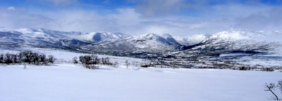

View from the Galten track
Foto: Jan Mielke
Foto: Jan Mielke
Back to the overview map
Track statististics
| Altitude difference: | 189 m | ||
| Lowest point: | 845 m | Highest point: | 1034 m |
| Vertical meters up: | 199 m | Vertical meters down: | 203 m |
| Steepest up: | 13.6 % | Steepest down: | 15.6 % |
| Longest up: | 2801 m | with a altitude difference of 184 m | |
| Longest down: | 2065 m | with a altitude difference of 88 m | |
| Incline/Decline | >15% | 10% - 15% | 5% - 10% |
| Up | 0 m | 602 m | 1237 m |
| Down | 46 m | 191 m | 1570 m |
| Plane (±4%) | 3754 m |